In late February on a warm weekend morning, I began pedaling Colchester's roads. The first outing involved tacking on 4-5 miles after checking on our family's camp in northern Burlington. I often stop on my favorite Burlington/Colchester border: the pedestrian/bike bridge spanning the mouth of the Winooski River. On this particular morning, I was treated to ice flows moving beneath me, entering Lake Champlain plus hardcore kite boarders cresting waves in 35F degree water.
I also checked on Airport Park's bicycle rest stop, a project I was involved in a year ago, helping construct the covered table and erect the signage. Cyclist's and park users enjoy this spot and is often filled on warm summer days. I was pleased that the structure was holding up well. Afterwards, I looped through a few neighborhood streets.
On my second outing, I struggled with what to photograph. I pedaled through more non-descript neighborhoods filled with raised ranches and older homes falling in disrepair. And to be fair, brown grass is unappealing to start with! However, I came across a sweet miniature lighthouse decorating someone's front lawn, complete with lashed pilings and a crab.
 |
| I like the Airport Park neighborhood plus it's proximity to the causeway and waterfront trails. |
I am constantly looking at house styles though, certainly a side benefit to this challenge. Colchester has lots of older homes, but has infilled during the past 20 years with new housing developments so there is an interesting mix of old lakefront camps on leased property, 1960's ranches, and over-the-top construction, maximizing on lake views, plus every kind of style in between. There is a high percentage of private roads also - which I find curious, and now I understand, accounts for all the dotted lines on my map - not included in my "public roads" itinerary. I plan to read about Colchester's history, and in particular, why the high incidence of private roads and neighborhoods.


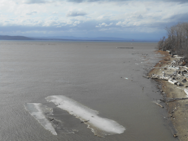
As I head back towards the waterfront trail, I observed the swollen Winooski River. The water is creeping up the boat ramp in this low-lying neighborhood. I was also reminded of the endangered Lake Surgeon, and because I'm not a fisherperson, it's easy to forget. There's a reason I've only seen this species in a tank.
From the fish and game access, it was a unique view of an area that's been under construction for seemingly a long time before housing goes up. I can tell there's been shoreline restoration and reinforcement, so perhaps the developer needed to get that part done before anything else.
Onward, I stop "on the border", a reversal loop of the previous excursion. This time, the mouth of the river is threatening Burlington's North Cove community. A lot has happened since that first ride, Hurricane Stella dropped 29" of snow, upriver snow is melting - just this week the lake level has risen 2 feet!
And when I look the opposite direction, I'm reminded how Burlington and Colchester are linked in more ways than one. Both communities share the river as a boundary, and in 2004 they came together to build and commemorate this wonderful bridge that walkers, pedalers, fisher-people, and tourists share - a precious connection that's a real treasure.


I love that you checked out the old houses -- I also like to see old architecture and check out the type of decoration that was used. Great pictures, too!
ReplyDelete